Look up OpenStreetMap objects and return sf objects
Source:R/geo_address_lookup_sf.R
geo_address_lookup_sf.RdLooks up addresses and other details for one or more OpenStreetMap (OSM)
objects, such as nodes, ways or relations. Results are returned as an
sf object. Use geo_address_lookup() to return a
tibble instead.
Arguments
- osm_ids
A numeric vector of OSM identifiers, for example
c(12345, 67890).- type
A character vector containing the OSM object type associated with each value in
osm_ids. Possible values are node ("N"), way ("W") and relation ("R"). A single value is recycled.- full_results
A logical value indicating whether to return all available fields from the Nominatim API. If
FALSE, only query metadata, geometry and requested address columns are returned.- return_addresses
A logical value indicating whether to include single-line addresses in the results.
- verbose
A logical value indicating whether to display detailed messages in the console.
- nominatim_server
A character string specifying the base URL of the Nominatim server. Defaults to
"https://nominatim.openstreetmap.org/".- custom_query
A named list of additional API parameters, for example
list(countrycodes = "US"). See Details.- points_only
A logical value indicating whether to return only point geometries. If
FALSE, the API may return other geometry types. See About geometry types.
Value
An sf object with the results that match the query.
Details
See https://nominatim.org/release-docs/latest/api/Lookup/ for additional
parameters to pass to custom_query.
About geometry types
The points_only argument controls whether the results contain only points.
All Nominatim results have at least a point geometry.
When points_only = FALSE, the geometry type depends on the matching
feature. Administrative areas and major buildings are returned as polygons,
rivers and roads are returned as lines and amenities may still be returned
as points.
This function is vectorized, allowing multiple addresses to be searched.
With points_only = FALSE, multiple geometry types may be returned.
See also
Address lookup functions:
geo_address_lookup()
Spatial output functions:
bbox_to_poly(),
geo_amenity_sf(),
geo_lite_sf(),
geo_lite_struct_sf(),
reverse_geo_lite_sf()
Examples
# \donttest{
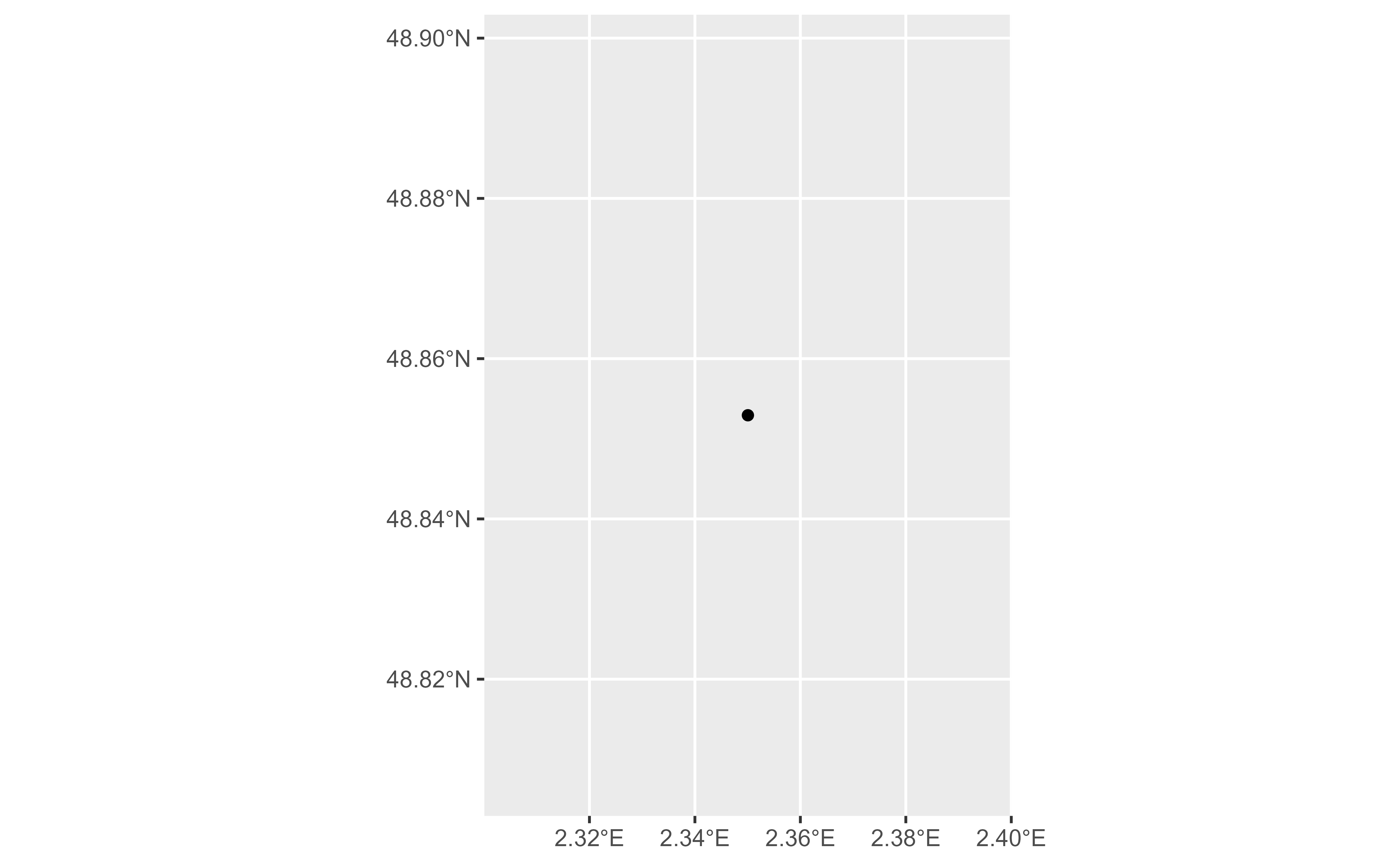
# Look up Notre-Dame Cathedral in Paris.
NotreDame <- geo_address_lookup_sf(osm_ids = 201611261, type = "W")
# Require at least one non-empty object.
if (!all(sf::st_is_empty(NotreDame))) {
library(ggplot2)
ggplot(NotreDame) +
geom_sf()
}
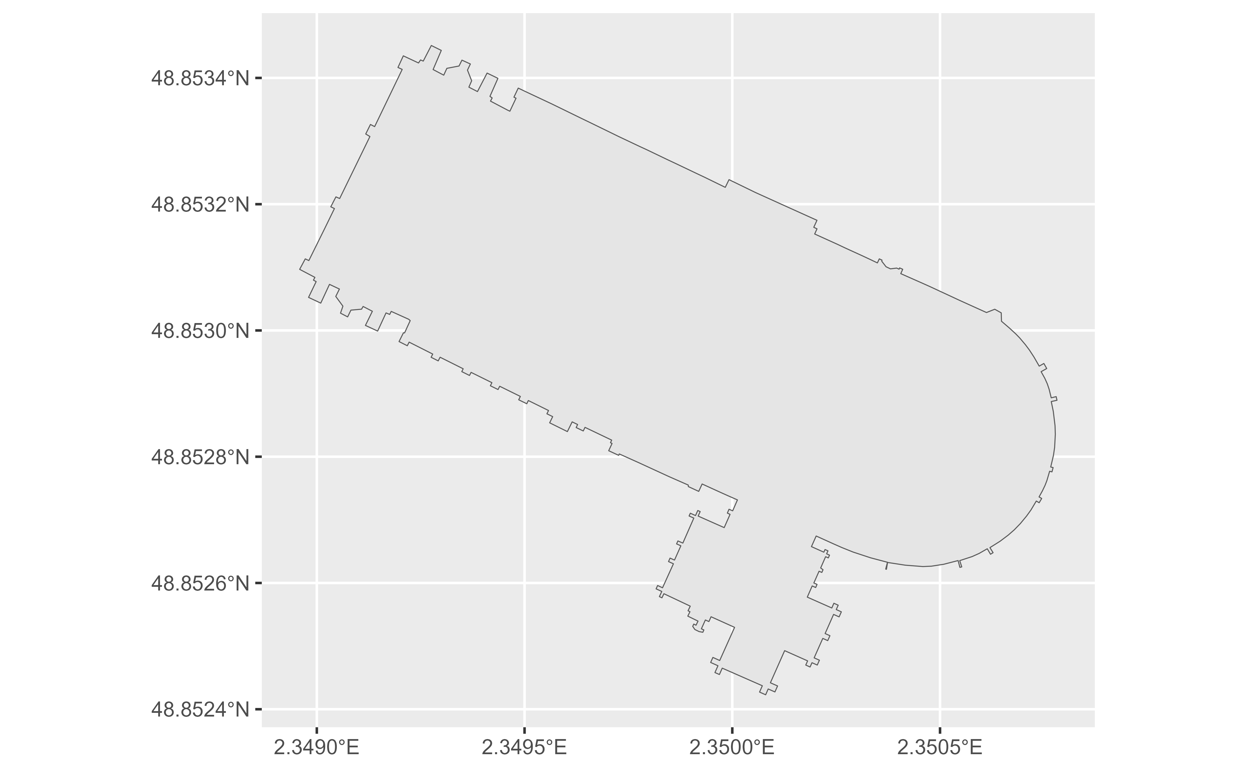
 NotreDame_poly <- geo_address_lookup_sf(201611261,
type = "W",
points_only = FALSE
)
if (!all(sf::st_is_empty(NotreDame_poly))) {
ggplot(NotreDame_poly) +
geom_sf()
}
NotreDame_poly <- geo_address_lookup_sf(201611261,
type = "W",
points_only = FALSE
)
if (!all(sf::st_is_empty(NotreDame_poly))) {
ggplot(NotreDame_poly) +
geom_sf()
}
 # Look up multiple OSM objects.
several <- geo_address_lookup_sf(c(146656, 240109189), type = c("R", "N"))
several
#> Simple feature collection with 2 features and 2 fields
#> Geometry type: POINT
#> Dimension: XY
#> Bounding box: xmin: -2.232455 ymin: 52.51739 xmax: 13.39513 ymax: 53.44246
#> Geodetic CRS: WGS 84
#> # A tibble: 2 × 3
#> query address geometry
#> * <chr> <chr> <POINT [°]>
#> 1 R146656 Manchester, Greater Manchester, England,… (-2.232455 53.44246)
#> 2 N240109189 Berlin, Deutschland (13.39513 52.51739)
# }
# Look up multiple OSM objects.
several <- geo_address_lookup_sf(c(146656, 240109189), type = c("R", "N"))
several
#> Simple feature collection with 2 features and 2 fields
#> Geometry type: POINT
#> Dimension: XY
#> Bounding box: xmin: -2.232455 ymin: 52.51739 xmax: 13.39513 ymax: 53.44246
#> Geodetic CRS: WGS 84
#> # A tibble: 2 × 3
#> query address geometry
#> * <chr> <chr> <POINT [°]>
#> 1 R146656 Manchester, Greater Manchester, England,… (-2.232455 53.44246)
#> 2 N240109189 Berlin, Deutschland (13.39513 52.51739)
# }