Attribution is required for all uses of this dataset.
This function returns boundary data for individual countries as they represent themselves, without any special identification of disputed areas.
If you require data that explicitly includes disputed areas, use
gb_get_world() instead.
Usage
gb_get(
  country,
  adm_lvl = "adm0",
  simplified = FALSE,
  release_type = c("gbOpen", "gbHumanitarian", "gbAuthoritative"),
  quiet = TRUE,
  overwrite = FALSE,
  path = NULL
)
Source
geoBoundaries API Service https://www.geoboundaries.org/api.html.
Arguments
- country
Character vector of country identifiers. This can be
"all"(to return data for all countries), a vector of country names, or ISO3 country codes. See alsocountrycode::countrycode().- adm_lvl
Type of boundary to retrieve. Accepted values are
"all"(all available administrative levels) or a specific ADM level."adm0"corresponds to country boundaries,"adm1"to first-level subnational boundaries,"adm2"to second-level boundaries, and so on. Uppercase variants (e.g."ADM1") and numeric values (0,1,2,3,4,5) are also accepted.- simplified
logical. If
TRUE, return simplified boundaries. IfFALSE(the default), use the premier geoBoundaries release.- release_type
One of
"gbOpen","gbHumanitarian", or"gbAuthoritative". For most users,"gbOpen"(the default) is recommended, as it is CC-BY 4.0 compliant and suitable for most purposes provided proper attribution is given:"gbHumanitarian"files are mirrored from UN OCHA and may have more restrictive licensing."gbAuthoritative"files are mirrored from UN SALB and cannot be used for commercial purposes, but are verified through in-country processes.
- quiet
logical. If
TRUE, suppress informational messages.- overwrite
logical. If
TRUE, force a fresh download of the source.zipfile, even if it is already cached.- path
Character. Path to a cache directory. If
NULL(the default), data are stored in the default cache directory (seegb_set_cache()). If no cache directory has been configured, files are stored in a temporary directory (seebase::tempdir()).
Value
An sf object containing the requested boundaries.
Details
Individual boundary files in the geoBoundaries database are governed by the
license or licenses specified in their associated metadata (see
gb_get_metadata()). Users working with individual boundary files should
ensure that they comply with these licenses and cite the original data
sources listed in the metadata. See Examples.
The following convenience wrappers are also available:
gb_get_adm0()returns country boundaries.gb_get_adm1()returns first-level administrative boundaries (e.g. states in the United States).gb_get_adm2()returns second-level administrative boundaries (e.g. counties in the United States).gb_get_adm3()returns third-level administrative boundaries (e.g. municipalities in some countries).gb_get_adm4()returns fourth-level administrative boundaries.gb_get_adm5()returns fifth-level administrative boundaries.
References
Runfola, D. et al. (2020) geoBoundaries: A global database of political administrative boundaries. PLoS ONE 15(4): e0231866. doi:10.1371/journal.pone.0231866 .
See also
Other API functions:
gb_get_adm,
gb_get_world()
Examples
# \donttest{
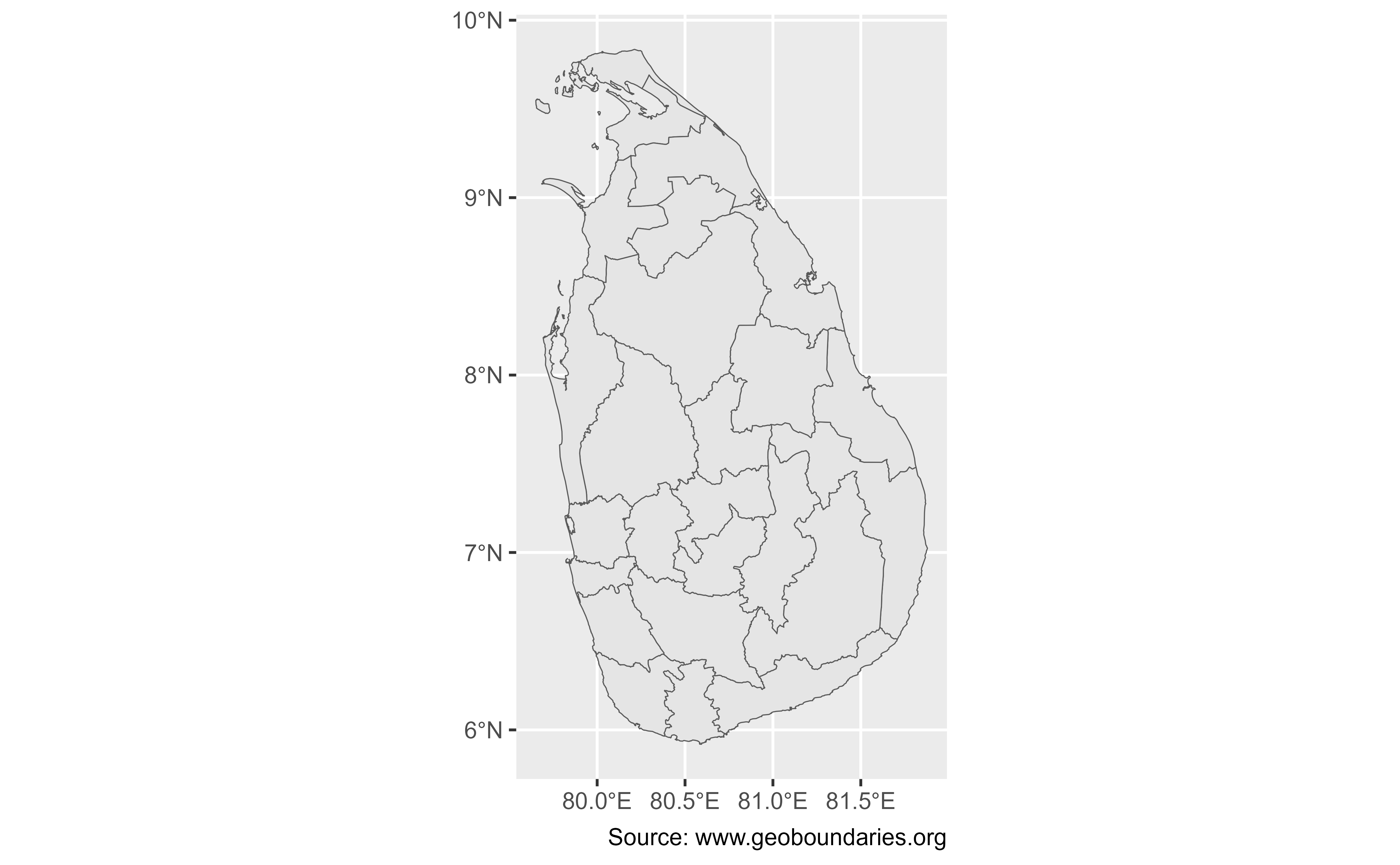
# Level 2 administrative boundaries in Sri Lanka
sri_lanka <- gb_get(
"Sri Lanka",
adm_lvl = 2,
simplified = TRUE
)
sri_lanka
#> Simple feature collection with 25 features and 5 fields
#> Geometry type: MULTIPOLYGON
#> Dimension: XY
#> Bounding box: xmin: 79.65102 ymin: 5.919017 xmax: 81.87896 ymax: 9.835791
#> Geodetic CRS: WGS 84
#> # A tibble: 25 × 6
#> shapeName shapeISO shapeID shapeGroup shapeType geometry
#> * <chr> <chr> <chr> <chr> <chr> <MULTIPOLYGON [°]>
#> 1 Jaffna Distr… LK-41 463711… LKA ADM2 (((79.7152 9.529465, 79.…
#> 2 Kilinochchi … LK-42 463711… LKA ADM2 (((80.01015 9.472403, 80…
#> 3 Mannar Distr… LK-43 463711… LKA ADM2 (((80.11535 9.209068, 80…
#> 4 Mullaitivu D… LK-45 463711… LKA ADM2 (((80.61353 9.456581, 80…
#> 5 Vavuniya Dis… LK-44 463711… LKA ADM2 (((80.23541 8.680412, 80…
#> 6 Galle Distri… LK-31 463711… LKA ADM2 (((79.98757 6.440352, 79…
#> 7 Hambantota D… LK-33 463711… LKA ADM2 (((80.67006 6.306029, 80…
#> 8 Matara Distr… LK-32 463711… LKA ADM2 (((80.3818 5.965264, 80.…
#> 9 Ampara Distr… LK-52 463711… LKA ADM2 (((81.70788 6.51073, 81.…
#> 10 Anuradhapura… LK-71 463711… LKA ADM2 (((80.03237 8.527211, 80…
#> # ℹ 15 more rows
library(ggplot2)
ggplot(sri_lanka) +
geom_sf() +
labs(caption = "Source: www.geoboundaries.org")
 # }
# Inspect metadata and licensing
library(dplyr)
#>
#> Attaching package: 'dplyr'
#> The following objects are masked from 'package:stats':
#>
#> filter, lag
#> The following objects are masked from 'package:base':
#>
#> intersect, setdiff, setequal, union
gb_get_metadata(
"Sri Lanka",
adm_lvl = 2
) |>
select(boundaryISO, boundaryType, licenseDetail, licenseSource) |>
glimpse()
#> Rows: 1
#> Columns: 4
#> $ boundaryISO <chr> "LKA"
#> $ boundaryType <chr> "ADM2"
#> $ licenseDetail <chr> "Open Data Commons Open Database License 1.0"
#> $ licenseSource <chr> "www.openstreetmap.org/copyright"
# }
# Inspect metadata and licensing
library(dplyr)
#>
#> Attaching package: 'dplyr'
#> The following objects are masked from 'package:stats':
#>
#> filter, lag
#> The following objects are masked from 'package:base':
#>
#> intersect, setdiff, setequal, union
gb_get_metadata(
"Sri Lanka",
adm_lvl = 2
) |>
select(boundaryISO, boundaryType, licenseDetail, licenseSource) |>
glimpse()
#> Rows: 1
#> Columns: 4
#> $ boundaryISO <chr> "LKA"
#> $ boundaryType <chr> "ADM2"
#> $ licenseDetail <chr> "Open Data Commons Open Database License 1.0"
#> $ licenseSource <chr> "www.openstreetmap.org/copyright"