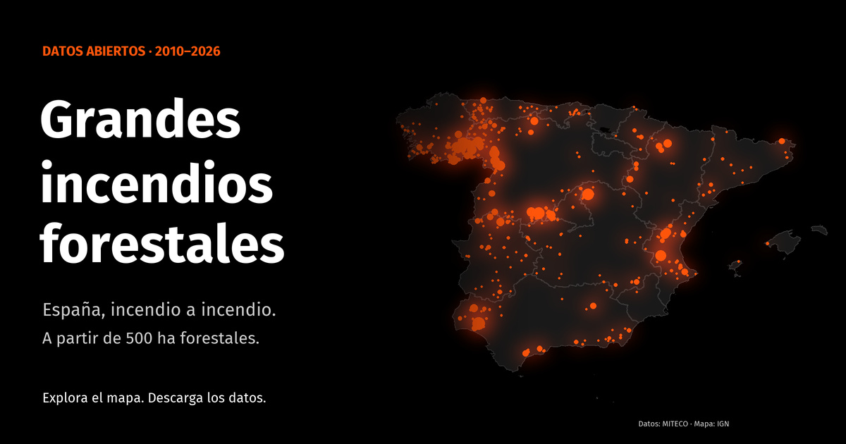

GIFs provides a dataset and an infographic of large forest fires in Spain, compiled from the statistics of the Ministry for the Ecological Transition and the Demographic Challenge (MITECO). Here, GIF means gran incendio forestal: a fire with at least 500 hectares of forest area burned.
The project uses R to prepare the data and create a map inspired by Dominic Royé’s firefly cartography.
Data and interpretation
Records span February 27, 2010 to September 26, 2026. These dates mark the first and last records in the dataset; they do not represent complete annual coverage. The dataset is not a real-time fire monitoring service.
The CSV contains municipality and province names, INE codes, dates and forest area burned in hectares. It combines final statistics for 2010–2021 with provisional reports for 2022–2026. Dates recorded as December 31, 2012 identify the year only, rather than a confirmed day of ignition.
Map points use municipal reference locations from mapSpain, not exact fire locations or perimeters. Circle sizes aggregate forest area burned at each reference location.
Downloads and reuse
The project website provides the infographic, a CSV download and citation information. Consult its documented methodology for collection decisions, source limitations and validation. Machine-readable field descriptions are available in the Croissant metadata.
Data reuse follows the MITECO legal notice, including attribution and preservation of the original conditions and metadata. The repository’s MIT license applies to its code and documentation. The project is independent and does not imply MITECO participation or endorsement.
Cite the dataset using its Zenodo DOI.