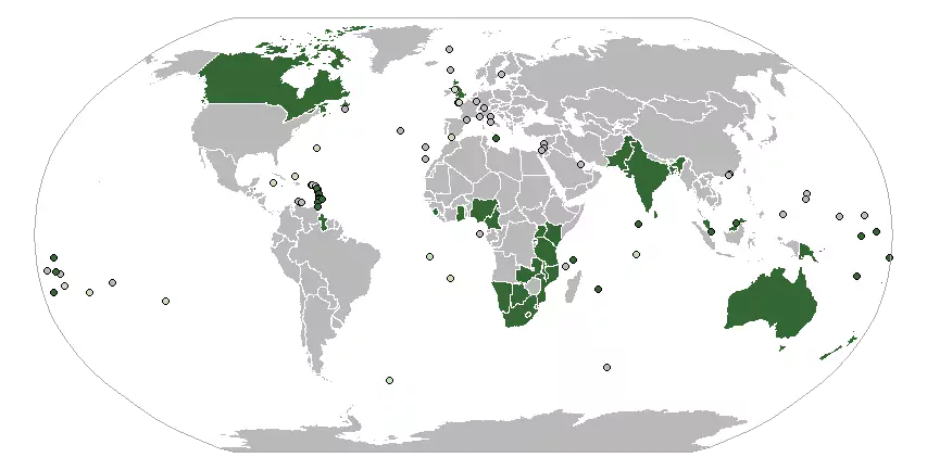
This vignette shows how to use the database provided in the GitHub project Country Codes and International Organizations & Groups with the sf package in R.
Required R packages
library(sf)
library(jsonlite)
library(rnaturalearth)
library(dplyr)
Reading the data
The first step is to read the provided database (in this example, the json
file) and extract one international organization. In this example, we will plot
the Commonwealth of Nations.
df <- fromJSON("https://raw.githubusercontent.com/dieghernan/Country-Codes-and-International-Organizations/master/outputs/Countrycodesfull.json")
# Identify Commonwealth acronym
orgsdb <- read.csv("https://raw.githubusercontent.com/dieghernan/Country-Codes-and-International-Organizations/master/outputs/CountrycodesOrgs.csv") %>%
  distinct(org_id, org_name)

kable(orgsdb[grep("Common", orgsdb$org_name), ], format = "markdown")
| org_name | org_id | |
|---|---|---|
| 25 | Commonwealth | C |
| 26 | Central American Common Market | CACM |
| 30 | Caribbean Community and Common Market | CARICOM |
| 42 | Commonwealth of Independent States | CIS |
| 43 | Common Market for Eastern and Southern Africa | COMESA |
| 115 | Southern Cone Common Market | MERCOSUR |
In our case, the value to search for is C. A function that extracts the
membership from the json database is also provided:
ISO_memcol <- function(df,
                       orgtosearch) {
  ind <- match(orgtosearch, unlist(df[1, "org_id"]))
  or <- lapply(1:nrow(df), function(x) {
    unlist(df[x, "org_member"])[ind]
  })
  or <- data.frame(matrix(unlist(or)), stringsAsFactors = F)
  names(or) <- orgtosearch
  df2 <- as.data.frame(cbind(df, or, stringsAsFactors = F))
  return(df2)
}
df_org <- ISO_memcol(df, "C")
Now df_org has a new column, named C, containing the membership status
of each country.
df_org %>%
  count(C) %>%
  kable(format = "markdown")
| C | n |
|---|---|
| member | 53 |
| NA | 222 |
df_org %>%
  filter(!is.na(C)) %>%
  select(
    ISO_3166_3,
    NAME.EN,
    C
  ) %>%
  head() %>%
  kable(format = "markdown")
| ISO_3166_3 | NAME.EN | C |
|---|---|---|
| ATG | Antigua & Barbuda | member |
| AUS | Australia | member |
| BHS | Bahamas | member |
| BGD | Bangladesh | member |
| BRB | Barbados | member |
| BLZ | Belize | member |
Replacing the data on a map
In this example the rnaturalearth package is used for retrieving an sf
object. The code below replaces the data.frame part of the sf object with
the dedicated database.
testmap <- ne_countries(50,
  "countries",
  returnclass = "sf"
) %>%
  select(ISO_3166_3 = adm0_a3) %>%
  full_join(df_org)

# We also add tiny countries
tiny <- ne_countries(50,
  "tiny_countries",
  returnclass = "sf"
) %>%
  select(ISO_3166_3 = adm0_a3) %>%
  full_join(df_org)

# Identify dependencies
ISOCommon <- df_org %>%
  filter(!is.na(C)) %>%
  select(
    ISO_3166_3.sov = ISO_3166_3,
    C_sov = C
  )
tiny <- left_join(tiny, ISOCommon)
tiny$C <- coalesce(tiny$C, tiny$C_sov)
Plotting a map: Wikipedia style
Now we will try to plot a map resembling the one presented in the Wikipedia page for the Commonwealth.
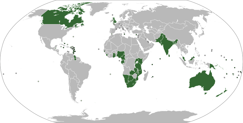
The map we will generate is presented in a Robinson projection, and the color palette will be based on the Wikipedia convention for Orthographic Maps, since it is the one used in the example.
# Projecting the map
testmap_rob <- st_transform(testmap, "+proj=robin")
tiny_rob <- st_transform(tiny, "+proj=robin")

# Bounding box
bbox <- st_linestring(rbind(
  c(-180, 90),
  c(180, 90),
  c(180, -90),
  c(-180, -90),
  c(-180, 90)
)) %>%
  st_segmentize(5) %>%
  st_cast("POLYGON") %>%
  st_sfc(crs = 4326) %>%
  st_transform(crs = "+proj=robin")

# Plotting
par(mar = c(0, 0, 0, 0), bg = NA)
plot(bbox,
  col = "#FFFFFF",
  border = "#AAAAAA",
  lwd = 1.5
)
plot(
  st_geometry(testmap_rob),
  col = "#B9B9B9",
  border = "#FFFFFF",
  lwd = 0.1,
  add = T
)

plot(
  st_geometry(testmap_rob %>%
    filter(!is.na(C))),
  col = "#346733",
  border = "#FFFFFF",
  lwd = 0.1,
  add = T
)

# Finally, add tiny countries
# All
plot(
  st_geometry(tiny_rob),
  col = "#000000",
  bg = "#B9B9B9",
  add = T,
  pch = 21
)
# Dependencies
plot(
  st_geometry(tiny_rob %>%
    filter(!is.na(C)) %>%
    filter(!is.na(ISO_3166_3.sov))),
  bg = "#C6DEBD",
  col = "#000000",
  pch = 21,
  add = T
)
# Independent
plot(
  st_geometry(tiny_rob %>%
    filter(!is.na(C)) %>%
    filter(is.na(ISO_3166_3.sov))),
  bg = "#346733",
  col = "#000000",
  pch = 21,
  add = T
)
plot(bbox,
  col = NA,
  border = "#AAAAAA",
  lwd = 1.5,
  add = T
)