Finds places that match one or more categories near a location or within a bounding box.
See arc_categories for a detailed explanation and available values.
To obtain results, provide either a pair of coordinates, x and y, as a
search origin or a bounding box in bbox to define the search extent.
You can combine both approaches by providing x, y and bbox. See
Examples.
Usage
arc_geo_categories(
  category,
  x = NULL,
  y = NULL,
  bbox = NULL,
  name = NULL,
  lat = "lat",
  long = "lon",
  limit = 1,
  full_results = FALSE,
  verbose = FALSE,
  custom_query = list(),
  ...
)
Arguments
- category
A place or address type used to filter results. Multiple values can be supplied as a vector (for example,
c("Cinema", "Museum")), which performs one call for each value. See Details.- x
A numeric vector of longitude values in the range \(\left[-180, 180 \right]\).
- y
A numeric vector of latitude values in the range \(\left[-90, 90 \right]\).
- bbox
A numeric vector specifying a bounding box used to limit the search. It must contain longitude (
x) and latitude (y) values in the formc(xmin, ymin, xmax, ymax). See Details.- name
An optional string containing the name or address to match.
- lat
Name of the latitude or y-coordinate column in the output. The default is
"lat".- long
Name of the longitude or x-coordinate column in the output. The default is
"lon".- limit
Maximum number of results per query. The ArcGIS REST API limits a single request to 50 results.
- full_results
A logical value indicating whether to return all available API fields via
outFields = "*". The default isFALSE.- verbose
A logical value indicating whether to display API request details.
- custom_query
A named list with additional API parameters.
- ...
Arguments passed on to
arc_geosourcecountryCountry filter using ISO codes (for example,
"USA"). Multiple values can be supplied as a comma-separated string.outsrSpatial reference of the output coordinates. The default is
NULL, which uses the service default. See Details and arc_spatial_references.langcodeLanguage of the returned addresses.
Value
A tibble with one or more matches for each query. For descriptions of the available fields, see ArcGIS REST API service output.
Details
Bounding boxes can be located using online tools, such as Bounding Box Tool.
For a full list of valid categories, see arc_categories. This function is
vectorized over category, which means it performs one independent call
to arc_geo() for each category value.
arc_geo_categories() also understands a single string of categories
separated by commas ("Cinema,Museum"), which is treated internally as
c("Cinema", "Museum").
outsr
The spatial reference can be specified as a well-known ID (WKID). If not specified, the spatial reference of the output locations is the same as that of the service (WGS 84, that is, WKID 4326).
See arc_spatial_references for values and examples.
See also
arc_categories lists supported values.
ArcGIS REST API category filtering provides API details.
Geocoding and reverse geocoding functions:
arc_geo(),
arc_geo_multi(),
arc_reverse_geo()
Examples
# \donttest{
# Full workflow: gas stations near Carabanchel, Madrid.
# Geocode Carabanchel.
carab <- arc_geo("Carabanchel, Madrid, Spain")
# Extract the CRS.
carab_crs <- unique(carab$latestWkid)
library(ggplot2)
base_map <- ggplot(carab) +
geom_point(aes(lon, lat), size = 5, color = "red") +
geom_rect(aes(xmin = xmin, xmax = xmax, ymin = ymin, ymax = ymax),
fill = NA,
color = "blue"
) +
coord_sf(crs = carab_crs)
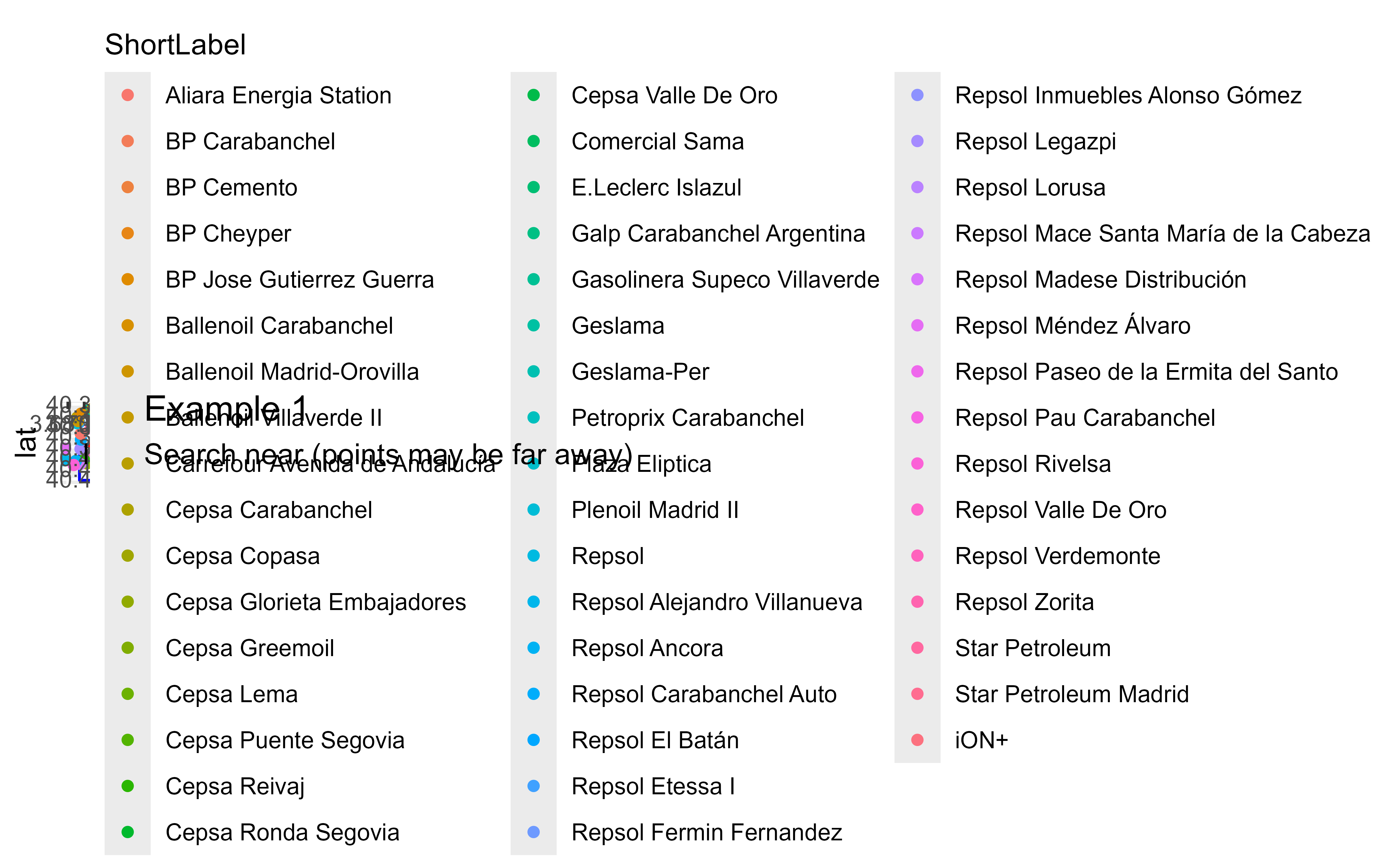
# Example 1: Search near Carabanchel (not restricted).
ex1 <- arc_geo_categories("Gas Station",
# Use Carabanchel as the search origin.
x = carab$lon, y = carab$lat,
limit = 50, full_results = TRUE
)
# Reduce labels to the most common ones.
library(dplyr)
labs <- ex1 |>
count(ShortLabel) |>
slice_max(n = 7, order_by = n) |>
pull(ShortLabel)
base_map +
geom_point(data = ex1, aes(lon, lat, color = ShortLabel)) +
scale_color_discrete(breaks = labs) +
labs(
title = "Example 1",
subtitle = "Search near (points may be far away)"
)
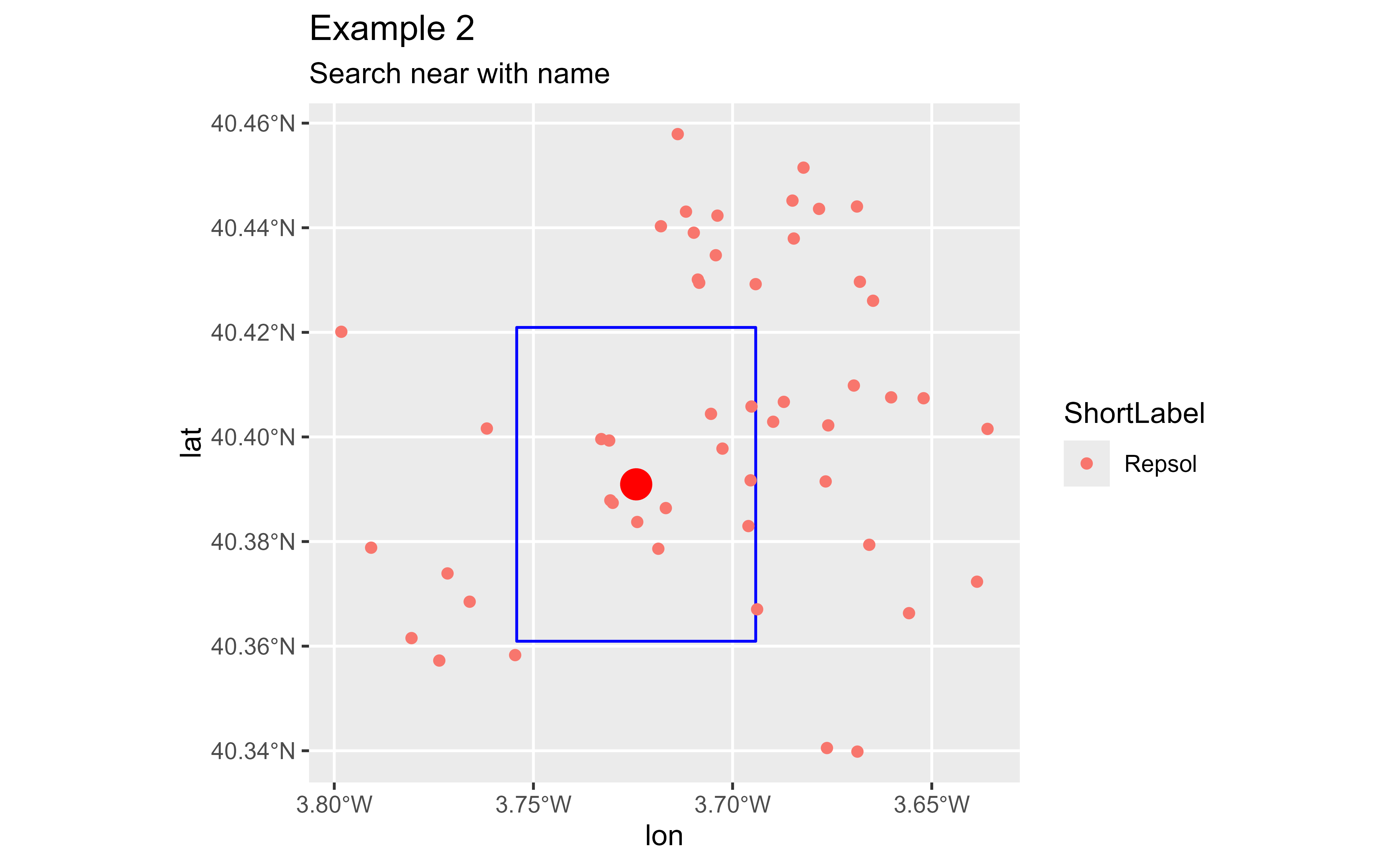
 # Example 2: Include part of the name for different results.
ex2 <- arc_geo_categories("Gas Station",
# Match this name.
name = "Repsol",
# Use Carabanchel as the search origin.
x = carab$lon, y = carab$lat,
limit = 50, full_results = TRUE
)
base_map +
geom_point(data = ex2, aes(lon, lat, color = ShortLabel)) +
labs(
title = "Example 2",
subtitle = "Search near with name"
)
# Example 2: Include part of the name for different results.
ex2 <- arc_geo_categories("Gas Station",
# Match this name.
name = "Repsol",
# Use Carabanchel as the search origin.
x = carab$lon, y = carab$lat,
limit = 50, full_results = TRUE
)
base_map +
geom_point(data = ex2, aes(lon, lat, color = ShortLabel)) +
labs(
title = "Example 2",
subtitle = "Search near with name"
)
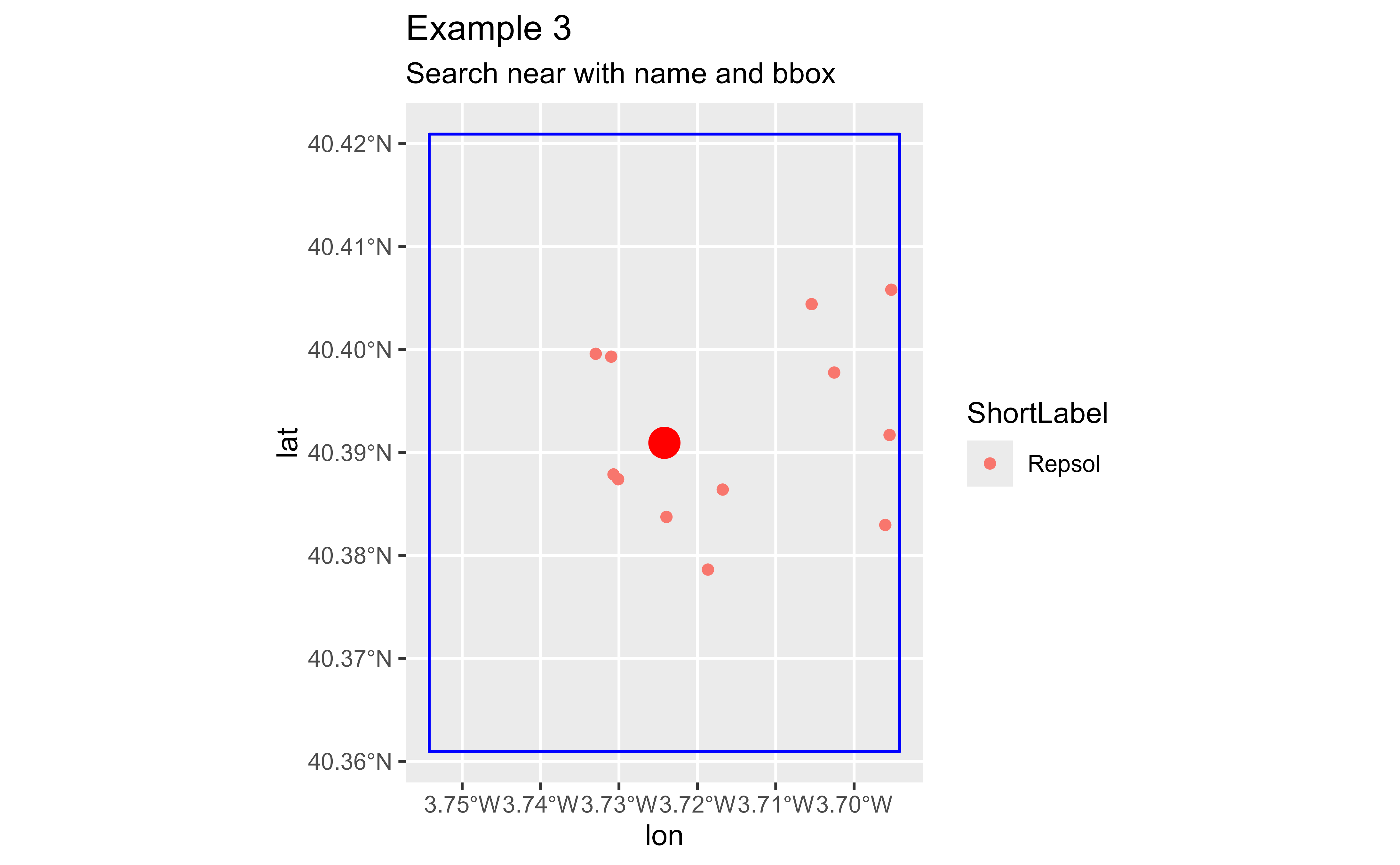
 # Example 3: Search within a bounding box.
ex3 <- arc_geo_categories("Gas Station",
name = "Repsol",
bbox = c(carab$xmin, carab$ymin, carab$xmax, carab$ymax),
limit = 50, full_results = TRUE
)
base_map +
geom_point(data = ex3, aes(lon, lat, color = ShortLabel)) +
labs(
title = "Example 3",
subtitle = "Search near with name and bounding box"
)
# Example 3: Search within a bounding box.
ex3 <- arc_geo_categories("Gas Station",
name = "Repsol",
bbox = c(carab$xmin, carab$ymin, carab$xmax, carab$ymax),
limit = 50, full_results = TRUE
)
base_map +
geom_point(data = ex3, aes(lon, lat, color = ShortLabel)) +
labs(
title = "Example 3",
subtitle = "Search near with name and bounding box"
)
 # }
# }